Mapin
Talk to Mapin
UNDERGROUND DATA PLATFORM

The underground, finally visible,
digital and intelligent.

Field data, existing records and AI in one platform for mapping, visualizing and managing underground infrastructure.

Discuss my project

Data is
the product.

Mapin brings field surveys and existing records together in a data platform for understanding, monitoring and managing underground infrastructure.

Follow the data journey
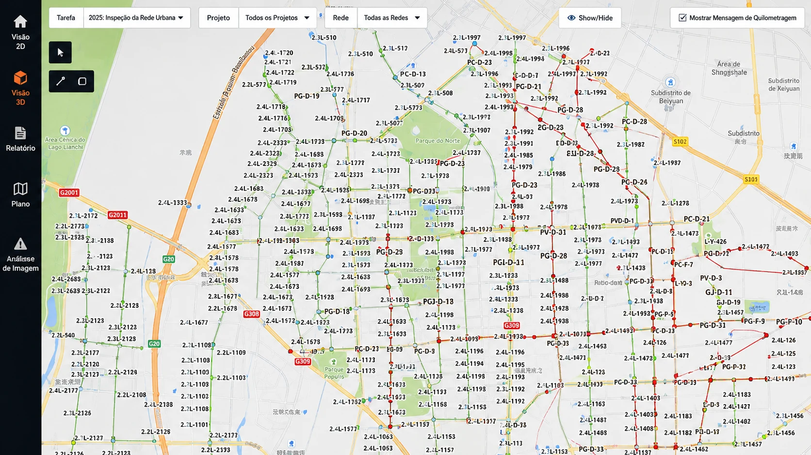
MapinData platform
Task2025: Urban Network Inspection
ProjectAll projects
NetworkAll networks
Underground network map with colored routes and asset identifiers
Interface previewGeoreferenced view

The surface is
just the beginning.

A new perspective changes how you understand the territory. Try it.

MAPIN / EXPLORERIllustrative visualization
A city and its underground networks in layersIllustrative diagram of buildings above water, power and gas networks. Use the view and network controls to explore.SURFACEUNDERGROUND
23°33′ S
46°38′ W
SELECTED ASSET ↗

Water network

Depth1.80 mMaterialHDPE
FROM TERRITORY TO ASSET.Choose a perspective. Discover another layer.

Where there is infrastructure,
there is a new perspective.

Different challenges.
The same need for a clearer view.

WATER · GAS · POWER · TELECOM

The entire network.
One shared view.

A view of buried networks to support maintenance, expansion and coordination of works.

  • Organized asset records
  • Networks in their geographic context
  • Context for planning works
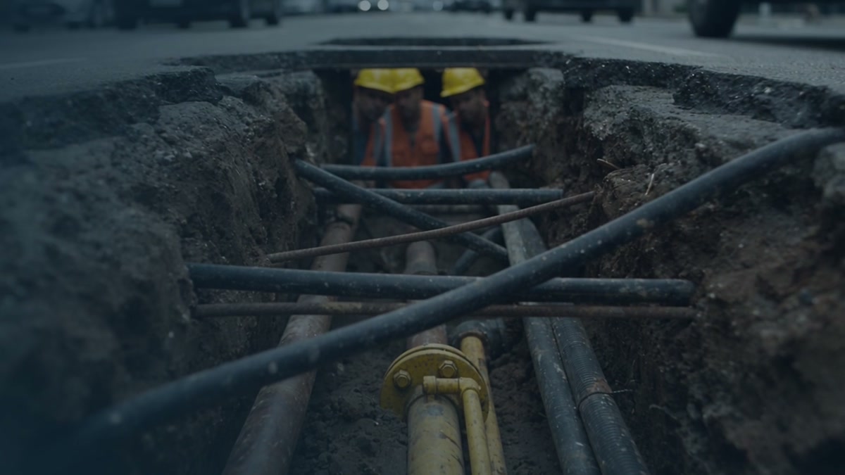
Underground networks in an infrastructure trench, from the Mapin film
Underground networks

From field to decision.
Everything connects.

Hardware captures what lies underground.
Software turns that data into information for your operation.

  1. 01Hardware · Field
    3D GPR sensing
    HardwareField data
    Field survey

    Capture.

    3D GPR sensing collects field data to reveal information about underground infrastructure.

    OutputField data

  2. 02Software · Processing
    Processing + AI
    Field dataExisting records
    IntegrateConnectOrganize

    Structure.

    Processing and artificial intelligence bring field data and legacy records together in an organized dataset.

    OutputConnected information
  3. 03Software · Platform
    GIS layers
    NetworksAssetsTerritory
    Information in context

    Visualize.

    On the platform, GIS layers and digital models connect assets to the territory to support analysis and planning.

    For your operationContext for decisions

Already have data? Your existing records can also enter the processing stage.

Connect to my project
WHY NOW

The future
has begun.

The underground data economy is just getting started.

Urbanization is accelerating.
More construction and more networks share the same space.
Infrastructure is aging.
Knowing your assets helps you plan maintenance.
Records are scattered.
Bringing data together helps coordinate works.
AI needs reliable data.
Analysis depends on the quality of the source information.
BEFORE YOU BEGIN

More clarity.
From the start.

What is Mapin?+

Mapin is an underground infrastructure data platform that combines sensing, processing and geographic visualization to support the management of buried assets.

Can I start with the data I already have?+

The approach includes legacy records and field data. The team can assess your data formats, quality and coverage to define the project scope.

Do I need a new field survey?+

That depends on the coverage and reliability of the available data, as well as the project goals. An initial conversation helps assess this need with the team.

How do I know if it fits my operation?+

Tell us about your sector and the challenge you want to solve. We can discuss deliverables, integrations, coverage and quality requirements for your situation.

YOUR NEXT STEP STARTS HERE

Ready to look
deeper?

Tell us what you need to understand.
We start with your situation.

Let's talk about your project.

↗

Share your challenge and explore the possibilities for your operation.

We will use this information to respond to your inquiry.

Prefer email? go@mapin.ai

Underground networks in context

Underground network map with colored routes and asset identifiers
CONNECT WITH MAPIN

The next step.
Together.

Explore opportunities for representation, technology integration and joint project development.

Commercial representationTechnology integrationJoint projects
MAPIN SOFTWARE

From map to detail.

MAPIN

A new perspective.